DJI Zenmuse L3 + 1 year DJI Care Enterprise Plus
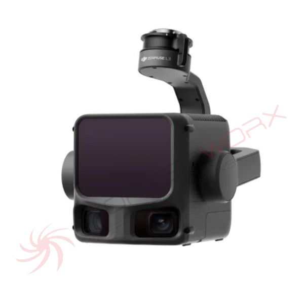
DJI Zenmuse L3
DJI's first high-precision airborne and long-range LiDAR system
The next-generation, high-precision DJI LiDAR system features a long-range LiDAR capable of detecting objects with as little as 10% reflectivity at distances of up to 950 meters. Two 100 MP RGB mapping cameras and a high-precision POS system accelerate geodata acquisition, enabling daily coverage of up to 100 km².
- 1535 nm long-range LiDAR
- Two 100 MP RGB mapping
- cameras
- High accuracy
- High penetration
- Up to 100 km² per day
- End-to-end solution
Hardware Performance Redefined:
The Zenmuse L3 combines a 1535 nm long-range LiDAR, two 100 MP RGB cameras, a high-precision POS system, and a three-axis gimbal in a compact device, delivering unprecedented performance for its size.
1535 nm Long-Range LiDAR:
Long Range, Wide Coverage.
The Zenmuse L3 achieves a maximum detection range of 950 m at a pulse rate of 100 kHz, tested at 100 klx ambient light and on objects with 10% reflectivity. The adjustable pulse rate allows for flexible beam power and optimal adaptation to different operational scenarios. Flights at altitudes of 300 to 500 m significantly increase the area covered per flight, making mapping more efficient.
Small measurement spot, high energy:
Thanks to a laser beam divergence of only 0.25 mrad (1/e²), the spot size at the same distance is about one-fifth that of the Zenmuse L2, allowing even small objects such as power lines or branches to be reliably detected. A higher energy density ensures greater penetration, significantly increasing the ground spot density under vegetation and enabling highly precise reconstruction of complex terrain features and structures.
High pulse frequency, multiple reflections:
With a maximum laser pulse frequency of 2 million points per second and up to 16 captured reflections, the Zenmuse L3 delivers highly precise spatial reconstructions. Point cloud density and penetration capability can be flexibly adapted to the requirements of high-precision mapping and complex environments.
Scan modes:
Supports linear, star-shaped, and non-repeating scan modes for various application scenarios:
- Linear: Ensures a more uniform point cloud distribution and is ideal for high-precision terrain surveying.
- Star-shaped: Provides a balance between accuracy, scan angle variety and penetration capability and is particularly suitable for forests or densely populated urban areas.
- Non-repeating: Allows multiple scan angles and greater coverage, and is optimized for the inspection of power lines and other complex structures.
Two 100MP RGB mapping cameras:
The Zenmuse L3 offers significantly higher accuracy and efficiency with two 100MP 4/3 CMOS RGB sensors and a mechanical shutter. Pixel binning technology enables an effective resolution of 25MP with larger pixels and ensures outstanding color reproduction even in low light conditions.
The two RGB mapping cameras have a horizontal field of view (FOV) of up to 107°, allowing each image to capture a wider area. Even with a lateral overlap of 20%, data for digital orthophoto maps (DOM) and digital elevation models (DEM) can be acquired in a single flight, significantly increasing work efficiency.
Precision meets efficiency:
The Zenmuse L3 achieves significant improvements in the accuracy of point clouds and RGB images, while also raising efficiency to a new level. When combined with the DJI Matrice 400, a single flight can cover up to 10 km², enabling high-precision mapping of up to 100 km² per day [2]. High-precision results across large areas are delivered in a seamless workflow.
High accuracy
Proprietary High-Precision System:
The improved high-precision POS system achieves a heading accuracy of 0.02° and a tilt accuracy of 0.01° (post-processed, 1σ). The proprietary LiDAR achieves a range repeatability of 5 mm at 150 m (1σ) [5] and supports microsecond-level time synchronization. Each unit undergoes rigorous factory calibration to ensure consistently reliable survey results.
LiDAR Data Accuracy:
Vertical accuracy is less than 3 cm at 120 m altitude, less than 5 cm at 300 m, and less than 10 cm at 500 m [6]. This easily supports mapping projects at scales of 1:500, 1:1000, and 1:2000. The point cloud generated by the Zenmuse L3 is only half the size of that of the Zenmuse L2, enabling more advanced analyses and high-precision applications.
Photogrammetric Accuracy:
With two 100 MP RGB mapping cameras, the Zenmuse L3 achieves a ground resolution (GSD) of 3 cm, even at an altitude of 300 m. Real-time position synchronization allows operation without ground control points (GCPs) and delivers high-quality images for precise mapping.
High Penetration:
High Ground Point Density:
Thanks to a smaller laser spot and higher single-pulse energy, the Zenmuse L3 has exceptionally high penetration capability. In terrain surveying and similar applications, it captures more ground points and delivers greater completeness, significantly improving the accuracy and integrity of terrain data for precise surface fitting and reconstruction.
High Efficiency:
In combination with the DJI Matrice 400, the Zenmuse L3 forms a highly efficient system. At an altitude of 300 m, a single flight can cover up to 10 km², enabling daily mapping of up to 100 km². It
simultaneously captures LiDAR and RGB data to generate various mapping outputs, such as DEM, DOM, and more, from a single flight.
End-to-end solution:
The Zenmuse L3 integrates seamlessly into the DJI ecosystem, providing a complete mapping solution. From data acquisition and processing to application, this unified workflow is easier to use and master than traditional multi-platform setups, allowing users to efficiently complete a wide range of mapping tasks.
Data acquisition:
Point cloud results preview:
DJI Pilot 2 automatically recommends optimal flight parameters based on user-defined routes and generates a density profile and point cloud distribution graphs before takeoff, providing a preview of the point cloud results.
Power Line Tracking:
The Zenmuse L3 significantly simplifies power line tracking and supports operations at altitudes of up to 130 m. In most cases, the Zenmuse L3 enables complete data capture of an entire power line corridor with a single, straight flight – without having to avoid obstacles or cross lines.
Flexible Split-Screen View:
DJI Pilot 2 supports split-screen viewing of any two data sources – point cloud, RGB, or Vision Assist – allowing for a flexible display combination that can be customized to your needs. When following power lines, or when the RGB cameras are facing downwards, Vision Assist provides real-time front views. This reduces flight risk and increases both efficiency and safety.
Real-Time Point Cloud:
Supports real-time SLAM point cloud reconstruction with instant 2D and 3D previews during the operation, allowing users to monitor progress and take measurements directly during data acquisition. Point cloud results can also be instantly uploaded to the cloud via DJI FlightHub 2, enabling rapid response and assessment in emergencies.
Cloud-based point cloud measurement:
The Zenmuse L3's point cloud outputs are fully compatible with DJI FlightHub 2. Users can view and manage point cloud data in real time, create detailed flight paths, mark and share points of interest, and perform advanced line and area measurements directly in the cloud.
Data processing:
Data processing with PPK:
DJI Terra offers powerful built-in Post-Processed Kinematic (PPK) capabilities that are compatible with both D-RTK 3 and standard base station data. The platform supports local PPK for RGB imagery and LiDAR, delivering centimeter-accurate positioning, even in regions with limited network coverage or no available RTK connection.
Gaussian Splatting with LiDAR Data:
DJI Terra enables advanced Gaussian Splatting-based fusion of point cloud and RGB data from the Zenmuse L3, significantly increasing the realism and detail of 3D models. This feature expands the application range of LiDAR to diverse mapping scenarios and delivers higher-quality 3D models.
Fusion-based modeling
DJI Terra enables the seamless integration of LiDAR and RGB data. With a single acquisition, users can simultaneously generate highly accurate point clouds, 2D maps, and 3D mesh models. This data fusion approach improves the completeness and detail of the models, especially in environments with complex structures such as bridges or substations. This meets the needs of industries such as energy, transportation, and infrastructure. DJI Modify's Smart Filter
data application supports the intelligent semantic classification of point clouds, automatically recognizing ground, vegetation, buildings, lines, power poles, and other features. After classification, users can efficiently adjust the categories using the quick selection and structure selection tools, further increasing classification accuracy and processing efficiency. The DJI Modify Profile Tool allows for the flexible selection of cross-sectional areas from point cloud models, enabling intuitive analysis of terrain deviations, structures, and elevation profiles. Comprehensive output capabilities: In combination with DJI Modify, the Zenmuse L3 delivers versatile results. DJI Modify automatically generates a variety of mapping products from point cloud data—including semantic point clouds, DEM, TIN, point grids, and contour lines—and enables multi-level visualization. These results meet the diverse requirements of engineering processes and CAD workflows. Data security: The Zenmuse L3 supports CFexpress™ memory card encryption, ensuring the security of stored data and preventing unauthorized access or data theft. The Matrice 400 allows for one-touch log deletion and encrypts video transmission with AES-256, further enhancing data security.
In the box:
1x Zenmuse L3
1x Zenmuse L3 Single Gimbal Connector
1x storage case
4x Gimbal Dampers
2x CFexpress Type B memory cards
1x CFexpress Type B card reader
1x DJI Matrice 400 case insert (Zenmuse L3)
1x lens cleaning cloth
Screws and tools