

DJI Zenmuse L2 vs L3: Which LiDAR System Is Right for You?
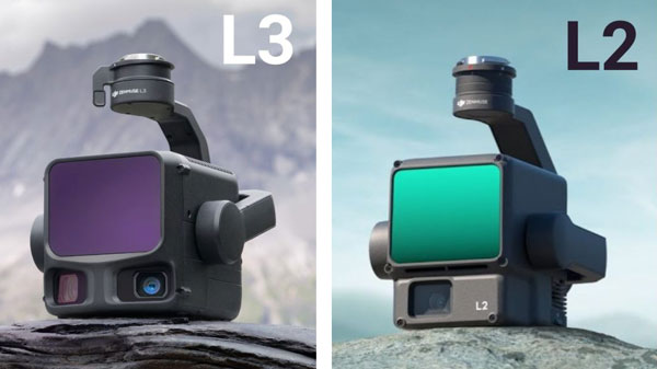
Compare DJI Zenmuse L2 and L3 by range, returns, cameras, accuracy and aircraft compatibility. Match the LiDAR workflow to your survey requirements.
DJI Zenmuse L2 and L3 are integrated airborne LiDAR systems for surveying, mapping, forestry and infrastructure projects. The L2 remains relevant for operators using compatible Matrice aircraft, while the L3 offers longer detection range, more returns and dual high-resolution RGB cameras on the Matrice 400 platform.
This guide compares the specifications and explains where each system fits into a professional mapping workflow.
DJI Zenmuse L2 vs L3: specification comparison
| Specification | Zenmuse L2 | Zenmuse L3 |
|---|---|---|
| LiDAR wavelength | 905 nm | 1535 nm |
| Detection range at 10% reflectivity / 100 klx | 250 m | Up to 950 m at 100 kHz |
| Maximum returns | 5 | Up to 16 (at specified pulse rates) |
| System accuracy (DJI test conditions) | 4 cm vertical / 5 cm horizontal at 150 m | 3 cm vertical / 4 cm horizontal at 120 m |
| RGB cameras | One 20 MP 4/3 CMOS camera | Two 100 MP 4/3 CMOS cameras |
| Combined RGB horizontal field of view | Approx. 73.7° | 107° |
| Compatible aircraft | Matrice 300 RTK (with RC Plus), Matrice 350 RTK and Matrice 400, subject to current DJI compatibility requirements | Matrice 400 with dedicated L3 connector |
| Indicative single-flight mapping coverage | Up to 2.5 km² | Up to 10 km² at 300 m, under DJI test conditions |
All quoted performance figures refer to specific DJI test conditions, not guaranteed results. Reflectivity, weather, terrain, vegetation, flight altitude, flight speed and processing methods affect actual results. Always follow local flight regulations.
1. LiDAR range and mapping productivity
The Zenmuse L2 has a specified 250 m detection range at 10% target reflectivity under 100 klx illumination. Under different conditions, DJI specifies up to 450 m for a 50% reflective target at 0 klx. The DJI Zenmuse L3 reaches up to 950 m at 10% reflectivity and 100 klx at its specified 100 kHz setting.
Longer detection range may permit higher-altitude acquisition where legally and operationally appropriate. DJI quotes up to 2.5 km² per flight for L2 and up to 10 km² for L3 with the DJI Matrice 400 at 300 m under specified conditions. These are not like-for-like guarantees for every survey.
2. Accuracy at different flight heights
DJI specifies L2 system accuracy of 4 cm vertical and 5 cm horizontal at 150 m. For L3, DJI specifies 3 cm vertical and 4 cm horizontal at 120 m, and 5 cm vertical and 7.5 cm horizontal at 300 m. Compare the test conditions, required deliverables and your own control-point verification rather than relying on a single headline figure.
3. Vegetation and multiple returns
L2 supports up to five returns; L3 supports up to sixteen at specified pulse rates. Multiple returns can improve the information collected from layered vegetation, where a pulse may interact with branches, leaves and surfaces below the canopy. Actual ground-point density still depends on canopy structure, flight planning and processing.
4. RGB mapping cameras
L2 integrates one 20 MP 4/3 CMOS camera. L3 adds two 100 MP 4/3 CMOS cameras with a combined 107° horizontal field of view. These support workflows that need both LiDAR and high-resolution RGB imagery, including coloured point clouds, orthophotos and 3D reconstruction.
5. Aircraft compatibility and upgrade planning
Compatibility is a major purchasing consideration. L2 supports the DJI Matrice 350 RTK, Matrice 300 RTK with the required controller, and Matrice 400 subject to DJI's current compatibility requirements. L3 requires the DJI Matrice 400 and its dedicated connector. An existing M350 operator cannot treat L3 as a simple payload-only upgrade.
Which system fits your project?
When L2 makes sense
- You already operate a compatible Matrice 300 RTK or Matrice 350 RTK.
- Your project size and flight altitude fit within L2's practical productivity.
- You do not need L3's additional range, return capability or RGB resolution.
When L3 makes sense
- You operate or plan to invest in Matrice 400.
- You regularly survey large areas, long corridors or complex vegetation.
- Higher acquisition efficiency and high-resolution RGB data are important to your workflow.
Frequently asked questions
Can Zenmuse L3 be installed on Matrice 350 RTK?
No. L3 is designed for Matrice 400 and requires its dedicated connector.
Does L3 always produce more ground points in forests?
No result is guaranteed. Its multiple-return capabilities and laser characteristics can help, but canopy conditions, flight settings and processing are decisive.
Does a longer LiDAR range mean I can fly at any altitude?
No. Mission planning must comply with applicable aviation rules, airspace restrictions and operational approvals.
Configure your DJI LiDAR solution
KopterWorx supplies professional DJI Enterprise systems and can help match aircraft, payload and workflow to your survey requirements. Explore Zenmuse L3, Matrice 350 RTK and Matrice 400, or contact us about your project.
Official sources
-
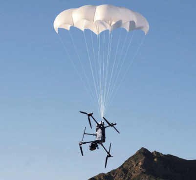 DJI AP100 Parachute for Matrice 400: Safety and C5/C6 Guide AP100 adds an integrated emergency parachute to Matrice 400. Understand deployment limits, maintenance and the important difference between C5 and C6 configurations.
-
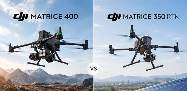 DJI Matrice 400 vs Matrice 350 RTK – Complete Comparison DJI Matrice 400 vs Matrice 350 RTK: compare flight time, payload capacity, obstacle sensing, transmission and Zenmuse compatibility to choose the right enterprise drone platform.
-
 Drone as First Responder: How DJI Dock Changes Alarm Response Drone as First Responder sends an aircraft to the incident before the ground team. See how DJI Dock, Matrice 5TD and FlightHub 2 reshape alarm response.
-
 DJI Matrice 5T Is Here: 59 Minutes, Native 1K Thermal and IP55 DJI Matrice 5T brings 59-minute flight time, native 1280 × 1024 thermal imaging, IP55 protection and a new combination of LiDAR, radar and advanced cameras. See what it means for demanding operations.
Powered by Mirasvit Magento 2 Extensions
- DJI Matrice 5T Is Here: 59 Minutes, Native 1K Thermal and IP55
- Drone as First Responder: How DJI Dock Changes Alarm Response
-
 DJI Dock 4 and Matrice 5TD: What 25-Second Battery Swaps Change
- DJI Matrice 400 vs Matrice 350 RTK – Complete Comparison
- DJI Zenmuse L2 vs L3: Which LiDAR System Is Right for You?