

Best Drone for Mapping in 2026: Surveying and GIS Guide
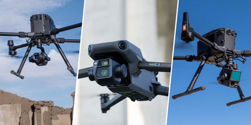
Choose a mapping drone by the data you need: orthophotos, 3D models or terrain beneath vegetation. Compare compact photogrammetry and Matrice LiDAR workflows.
The best drone for mapping is the one that reliably produces your required deliverables. A small construction site, a long infrastructure corridor and a wooded terrain survey place different demands on the aircraft, sensor and processing workflow. Start with the output specification rather than the longest headline flight time.
Define the deliverable first
- Orthophotos and textured 3D models: assess camera quality, image overlap and photogrammetry software.
- Survey deliverables: define the required coordinate system, accuracy and independent checks.
- Terrain under vegetation: evaluate whether a LiDAR workflow is appropriate.
- Repeat surveys: consider repeatable routes, consistent capture settings and processing time.
DJI Matrice 4E: compact mapping platform
Matrice 4E combines a 20 MP 4/3 camera with a mechanical shutter. DJI specifies a minimum 0.5-second photo interval and a maximum flight time of 49 minutes under its stated test conditions. A mechanical shutter helps control motion-related image distortion when capturing a mapping route.
It is a practical option to evaluate for teams that need a compact aircraft for regular surveying, construction progress and GIS capture. Include the controller, positioning corrections, software and field procedures when comparing complete systems.
DJI Mavic 3 Enterprise: consider the existing workflow
Mavic 3E also uses a 20 MP 4/3 wide camera with a mechanical shutter and supports the optional RTK module. For an organisation already using its batteries, controllers and processing tools, retaining a familiar platform may be more useful than replacing equipment for a single specification.
When a Matrice and LiDAR setup is appropriate
LiDAR and photogrammetry collect different kinds of measurements. A compatible Matrice aircraft with Zenmuse L2 or L3 is worth evaluating when terrain, vegetation or project scale makes a camera-only workflow unsuitable. Check the exact aircraft and payload combination before specifying a system.
| Workflow | What to prioritise |
|---|---|
| Compact photogrammetry | Mechanical shutter, repeatable routes, image quality and processing |
| Surveying and GIS | Positioning, control, checkpoints and coordinate-system handling |
| Vegetation and terrain | LiDAR suitability, point density and classification |
| Large or repeated projects | End-to-end field and processing productivity |
RTK is one part of the accuracy chain
An RTK FIX status is valuable, but it does not prove the final model meets your accuracy requirement. Camera calibration, capture geometry, corrections, terrain, control and processing all matter. Verify deliverables with independent checkpoints and document the coordinate reference system.
Plan the complete field kit
Compare batteries, charging, transport, correction services, software licences and staff training. A practical demonstration using representative terrain can reveal more than a catalogue comparison. Agree on how the resulting data will be checked before committing to a workflow.
Choose your setup at KopterWorx
Explore DJI Matrice 400 and Zenmuse L3, or contact KopterWorx to discuss a mapping setup matched to your project.
Powered by Mirasvit Magento 2 Extensions
-
 DJI Matrice 5T Is Here: 59 Minutes, Native 1K Thermal and IP55
-
 Drone as First Responder: How DJI Dock Changes Alarm Response
-
 DJI Dock 4 and Matrice 5TD: What 25-Second Battery Swaps Change
-
 DJI Matrice 400 vs Matrice 350 RTK – Complete Comparison
-
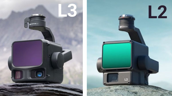 DJI Zenmuse L2 vs L3: Which LiDAR System Is Right for You?